For businesses reliant on efficient logistics solutions, understanding delivery processes is crucial. Many Amazon customers often question why they can’t see real-time truck locations during deliveries. This question speaks to broader themes of data integration, privacy considerations, and the technological infrastructure required for transparency. Each chapter of this article will delve into different aspects of this issue, from the complexities of data integration to the future prospects of delivery transparency, ultimately painting a clearer picture of why the exact location of Amazon trucks remains undisclosed.
Complex Data Integration: Why Doesn’t Amazon Show Where the Truck Is?
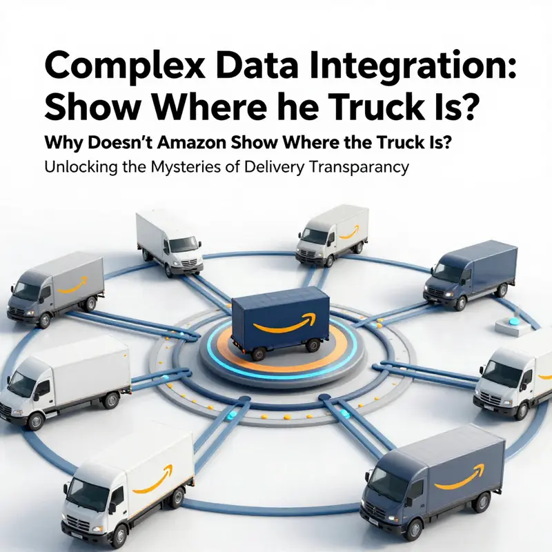
The question itself frames a paradox that sits at the heart of modern logistics: the technology to know exactly where a delivery vehicle stands exists, yet the public interface that accompanies a customer order rarely shows a live map with a moving truck. To understand why, we must follow the trail of data through a labyrinth of systems, partners, and choices about what information is comfortable to reveal. It begins with the scale of the operation. A single order can traverse multiple stages and touch a sprawling network of carriers, warehouses, and last‑mile partners. Each of those components generates streams of data—GPS pings, scanning events, momentary status changes, and handoff confirmations. The system that coordinates this is not a single, monolithic ticker; it is an orchestra of data feeds that must be synchronized, validated, and interpreted in near real time. The capability to map a vehicle to a precise longitude and latitude sits in the repertoire of the backend, but translating that precision into a clean customer experience is another matter entirely. The most reliable, customer‑facing view tends to favor stability and clarity over granularity. A moving dot on a map that appears to stall can create more anxiety than reassurance, triggering questions about accuracy, delays, or misrouting. The design choice is not about hiding information so much as shaping information to reduce confusion and set reasonable expectations. In other words, the visible truth to the shopper is not merely a question of capability; it is a product of deliberate prioritization, data governance, and user experience philosophy that guides what is surfaced and when.
Data integration, in practice, is the quiet backbone of this system. The backbone must fuse data from multiple sources—carrier systems, in‑vehicle trackers, warehouse management software, and delivery apps—into a cohesive flow that can feed both internal dashboards and customer interfaces. This is where complexity multiplies. Data can drift in timing, semantics, or quality. A shipment might register as “in transit” in one feed but “out for delivery” in another because a carrier relayed an update only intermittently. The integrity of the customer view hinges on consistent reconciliation: the system must decide which update is the authoritative one and how to present it. This is not a mere technical feat; it is a governance challenge about trust, latency, and the risk of misinterpretation. The system may be capable of streaming precise locations, yet the data that actually reaches the customer channel is filtered, aggregated, or resampled to preserve reliability. Real‑time, high‑fidelity visibility is balanced against the realities of network reliability, data throughput, and the sheer volume of daily movements. When the team builds the customer experience, it prioritizes what can be trusted in a consumer environment, rather than what the fleet is doing in every instant across a city grid.
Carrier integration and data sharing form another axis of this equation. Much of the delivery network is built on partnerships with third‑party carriers whose systems live outside the direct control of the retailer. Each partner carries its own data model, update cadence, and privacy constraints. Some carriers provide richer, more frequent status signals than others. Others may only convey a handful of events per stage, or rely on downstream partners to translate those signals into consumer‑facing updates. The result is a mosaic rather than a single, unified feed. In some cases, performance hinges on formal data-sharing arrangements that define what can be shared publicly, what can be projected into a customer account, and what must remain visible only to authorized partners or internal teams. A robust inbound tracking program exists to give sellers and fulfillment teams visibility into shipment progress as it moves toward a fulfillment center, yet this visibility is typically designed for inventory planning, not for public maps. The essence of the bottleneck is not the absence of technology but the absence of universal, low‑latency data alignment across all carriers in all regions. If a carrier’s system isn’t seamlessly integrated, updates may appear late or not at all in the customer interface. The integration web is threaded with contracts, data schemas, and escalation paths that can slow or limit the public sharing of live location data, even when the hardware in the trucks is capable of precise geolocation.
Privacy, security, and operational security also frame what is displayed. Real‑time location data, if exposed broadly, can present risks. A precise, publicly visible map could become an attractive target for theft, tampering, or abuse. The visibility that does exist within the network is carefully controlled and compartmentalized. Sensitive movement patterns and exact geolocations are protected, and the public feed is filtered to emphasize useful, non‑sensitive updates. This is not only a privacy concern; it is a risk management decision. The more detail that is disclosed, the greater the surface area for misuse. The public interface is designed to reduce risk while still delivering value, offering status categories like “in transit,” “out for delivery,” or “arriving soon” rather than a constantly updating GPS breadcrumb. It is a deliberate choice to shield certain dimensions of operational data from public exposure, even as the underlying systems hold the capacity for deeper, more granular visibility in controlled contexts.
The customer experience design further reinforces this approach. The aim is to provide a predictable, reassuring narrative about when a package will arrive, rather than a running commentary on every curve of the delivery route. A map with a drifting vehicle could mislead if a truck sits idle for a stretch or passes through a zone with weak signal, prompting questions about delays that aren’t necessarily real. The interface favors clarity and reliability over continuous play‑by‑play, offering estimated delivery windows and simple progress states that customers can interpret at a glance. The human factors side is essential: people respond better to adsorbing the big picture—the package is on the way, it will be delivered soon—than to decipher a stream of near‑instant updates that might be inaccurate or confusing. In a sense, the interface sacrifices some depth for interpretability, a trade‑off many large logistics platforms accept as part of maintaining a calm customer experience during the often stressful weeks when a package is en route.
Behind this public face lies a layered, highly connected system that can, in principle, pin a vehicle to a precise location. The technology exists to model and track movement with great fidelity, but the consumer channel is curated to balance performance, privacy, and perception. A portion of that precision is reserved for authorized users—partners, internal teams, and certain seller accounts—where near real‑time updates can inform inventory management, capacity planning, and operations optimization. These internal or partner views are designed to reduce friction and enable proactive decision making. They do not translate into the public consumer experience, which remains a streamlined, less granular portrait of shipment progress. The separation between internal visibility and external presentation is not an accident; it is a design choice rooted in reliability, governance, and the practical realities of coordinating hundreds of thousands of daily movements across a global network.
To illuminate the broader ecosystem without losing the thread of the core question, consider how the physical side of trucking ecosystems interacts with the digital one. The hardware and sensors on trucks, the gateways that report data to fleet management software, and the dashboards used by dispatchers all contribute to a robust, responsive system. In many ways, the public interface is a distilled version of that complexity—a consumer‑friendly lens that communicates the essentials while the behind‑the‑scenes data plumbing holds a depth and nuance that would be overwhelming if surfaced in real time. The result is a coherent experience that helps customers plan and manage expectations, even if it leaves some degree of precision in the shadows. If you want a tangible sense of how the broader logistics toolkit connects to everyday truck use and the interfaces that customers do encounter, you can explore broader resources about the role of hardware accessories and vehicle configurations in keeping fleets resilient and responsive. For a sense of how physical gear intersects with the logistics world, see Accessories.
In sum, the public decision not to display live truck coordinates is not a single algorithm or a simple policy. It is the outcome of a careful calibration across data integration complexity, carrier data sharing realities, privacy and security considerations, and the intent to design a user experience that reduces anxiety and increases trust. The backend can, in principle, produce a granularity that borders on real time; the frontend chooses a more conservative cadence to avoid misinterpretation and to protect sensitive operational details. The resulting pattern is a system that aims to be transparent about outcomes—when a package is on the way and when it will arrive—without exposing every movement in between. It is, ultimately, a compromise built on careful engineering, governance, and a commitment to customer confidence rather than an omission born of neglect.
External reference: For a broader technical overview of how location and tracking technologies operate in general, see https://en.wikipedia.org/wiki/GlobalPositioningSystem.
Tracking Beyond the Horizon: How FIST Shapes Visibility and Why Live Truck GPS Isn’t Public
![]()
When shoppers wonder why Amazon’s tracking interface never presents a live GPS map of the delivery truck, the answer sits at the intersection of data engineering, carrier partnerships, and practical risk management. The cargo on the move is real. Yet the stream of data that would show a precise truck location in real time isn’t what appears on the customer-facing screen. The reluctance to publish a rolling GPS trace is not about secrecy but about the hard realities of how logistics data flows across a sprawling network. Behind the familiar updates—order confirmed, in transit, out for delivery—lies a web of systems that must synchronize precisely, protect privacy, and maintain reliability at scale. Understanding that web helps explain why the most granular visibility available to sellers and partners stops short of a live truck’s coordinates in a consumer interface, even as the technology underpinning the operation continues to advance in meaningful ways.
At the core of visibility is data integration. Real-time truck tracking would require direct, continuous feeds from an individual carrier’s fleet management system. Carriers operate a mosaic of routing software, telematics, and private networks, often with varying update cadences and data schemas. For Amazon to surface live GPS data to customers, it would need to establish and maintain stable, high-frequency data streams with each carrier it relies on. That is a tall order, because every carrier system is different, and every integration introduces a potential point of failure. If the feed stutters or the GPS point is momentarily inaccurate, the public layout could mislead customers or create confusion for delivery planners who rely on the same data to optimize routes and staffing. Reliability, not speed, becomes the priority when the default consumer interface is what shapes expectations about delivery windows and service quality.
That reality helps explain why the common customer experience shows broad statuses like “In Transit” or “Out for Delivery” rather than a moving dot on a map. It is not that the data doesn’t exist; rather, the data is fragmented, variable in precision, and not routinely packaged for public consumption in real time. When a live feed is available in controlled environments, such as internal dashboards or certain partner portals, it is usually filtered, standardized, and reconciled against event-based milestones. The goal is to provide accurate, actionable information that supports planning and accountability, not a granular, always-on GPS trail that could be misread by nonexpert users.
Within this framework, the Fulfillment Inbound Shipping Tracking (FIST) program stands out as a crucial piece of the visibility puzzle, but with a distinct scope. FIST is designed to enhance end-to-end transparency for inbound shipments—those smaller parcels and Less-Than-Truckload (LTL) movements from sellers into Amazon’s fulfillment network. Through FIST, Amazon aggregates data from multiple third-party carriers and harmonizes it into a cohesive picture for the sender and for internal fulfillment workflows. This integration captures the nodes that matter for inventory planning: pickup, departure from origin, arrival at ports or hubs, customs processing where applicable, and delivery to the fulfillment center. It reduces manual input, minimizes data-entry errors, and improves operational efficiency by ensuring that the status updates flow automatically into the systems sellers use to track their inbound inventory.
Yet even with FIST, the product of visibility remains, for the most part, event-driven rather than GPS-driven. FIST can reliably surface milestones such as “In Transit,” “Arrived at Hub,” or “Out for Delivery” at the outbound stage from seller to fulfillment center. These signals help sellers anticipate inbound inventory arrivals, align warehouse staffing, and plan restocking cycles. They also provide a clearer audit trail for shipments that might otherwise be traced only through carrier phone calls or scattered emails. But the granular, continuous position of the actual truck en route to an origin facility is still outside the standard visibility envelope. The underlying carrier technologies often do not provide continuous GPS updates, or they do provide them but under strict usage rules and with data that must be filtered, normalized, and validated before it can be exposed in any system connected to customer-facing interfaces.
There is also a philosophy of data reliability and operational integrity at play. Publicly displaying live coordinates could breed anxiety if data were momentarily stale or inaccurate. An occasional GPS ping that lands the truck in a neighboring neighborhood, misread due to signal obstruction, or a misaligned timestamp could lead customers to misinterpret a delivery delay or misjudge the driver’s progress. From an operational perspective, planners must reconcile live carrier data with scheduling windows, facility capacity, and the day’s staffing. When those systems are out of sync, the risk of conveying misleading information rises. The emphasis on verified carrier events over raw GPS feeds helps prevent such misinterpretations and preserves trust in the delivery promise.
The practical effect for most shoppers is a predictable rhythm: you receive a delivery estimate, perhaps a window, and occasional status updates that indicate progression through the network. Sometimes the update cadence is more about service levels than pinpoint location. And even when a shipment is moving rapidly, the consumer interface is tuned to reflect milestones that are verifiable and actionable for both the customer and the logistics teams. This is not a denial of advanced tracking capabilities; it is a measured choice about what information is most useful and least confusing to the broad audience of shoppers.
The narrative becomes more nuanced when considering the higher levels of visibility that exist in internal or partner-facing contexts. For example, FIST’s integration helps Amazon and sellers monitor inbound shipments with near real-time awareness within Seller Central, a platform designed for vendors and retailers rather than for the general public. In such environments, the focus is on inventory flow, capacity planning, and performance analytics. The same data, in a different channel, can empower decisions about stocking strategies, lead times, and space allocation in fulfillment centers. The public experience, conversely, prioritizes a balance between transparency and simplicity. This balance aims to avoid overwhelming customers with data that could be misinterpreted if presented without the context that trained logisticians bring to the table.
Another layer in this story involves the human and hardware innovations that operate behind the scenes. Amazon’s internal teams have explored technologies like augmented reality assistance for drivers, which can streamline navigation and package verification in the field. These internal tools can improve efficiency and safety, yet they do not necessarily translate into a customer-facing map showing the exact truck position. The AR-enabled approaches illustrate a broader trend: the same core data streams and sensor inputs that enable precise orchestration of a fleet can be repurposed to optimize human performance and route compliance, even as the publicly visible footprint remains more conservative. The difference between internal utility and external presentation is deliberate, designed to protect privacy, maintain data integrity, and deliver a consistent customer experience.
For readers who want a sense of how the physical and digital layers connect, it helps to think of the logistics network as a multi-layered tapestry rather than a single thread. The outermost layer—the customer tracking interface—benefits from clarity and reliability. Beneath it lies a more complex ecosystem where event-driven updates, carrier data, and warehouse operations interlock to support inventory management and delivery commitments. The FIST initiative sits in the middle layer, stitching together inbound shipments with streamlined visibility for sellers and fulfillment networks, while the innermost layer holds the raw cartography of fleet movements that often remains private and tightly governed.
If you’re curious about how the tangible elements of the delivery ecosystem—such as hardware and outfittings on the vehicle and in the warehouse—interact with these digital processes, a focused look at truck accessories can be illuminating. The way a truck is equipped with sensing devices, racks, and modular add-ons can influence data capture and handoffs between stages of a shipment. A concise overview on hardware accessories provides context for how physical configurations support, or constrain, visibility outcomes. Accessories offers a useful portal into that side of the equation, bridging the hardware and software worlds in a way that complements the broader discussion of tracking.
The takeaway is practical and hopeful. Real-time truck location sharing, in the public sense, remains constrained by data integration realities, carrier partnerships, and the imperative for accurate, dependable information. FIST represents a meaningful improvement in inbound visibility, enabling better planning and accountability for shipments that pass through Amazon’s network. It demonstrates how a hybrid model—combining automated carrier events with centralized tracking workflows—can enhance transparency without overextending the system’s capacities or exposing sensitive operations to unnecessary risk. As data quality improves and partnerships grow more standardized, there may be gradual enhancements to what is possible to surface publicly. For now, the default remains a carefully chosen set of status updates, guided by reliability, privacy, and practical utility. The story of truck visibility is evolving, but it remains anchored in a principle: information is most valuable when it supports accurate decisions, not when it inflates the sense of immediacy with potentially noisy data.
External resource: https://sellercentral.amazon.com/gp/help/202681
AR at the Wheel: Why Real-Time Truck Location Isn’t Public in Amazon’s Delivery Network

The emergence of augmented reality (AR) in the delivery ecosystem has reshaped how drivers see their routes, what data they access, and how teams coordinate from dock to doorstep. Yet when customers ask why they can’t watch the exact GPS trail of a delivery truck on a live map, the answer isn’t simply “privacy” or “security.” It’s a layered decision that balances driver safety, data governance, user experience, and the practical limits of a sprawling, multi-carrier logistics operation. At first glance, the upgrade path seems obvious: if AR can guide a driver with real-time package details and turn-by-turn cues, surely the same data could be extended outward to customers in a now-caster-like display of location. Dig a little deeper, however, and you encounter a fabric of constraints that makes a public live-truck map not just technically demanding but strategically delicate. AR technology inside the delivery workflow has become a powerful internal tool, shaping efficiency, accuracy, and safety. It is not, by design, a portal for continuous public visibility into a moving vehicle. The rationale rests on four interlocking pillars: technical feasibility and privacy, user experience and cognitive load, existing tracking mechanisms, and broader commercial strategy that prioritizes flexibility and security over granular openness.
On the technical side, AR for drivers is about context, not dispersal. When drivers wear head-mounted displays, the devices pull data from the order, the route, and the vehicle’s own sensors to present only what the driver needs in real time. They see the next package, the delivery address, the customer instructions, and the navigation path as overlays in their field of view. This is a tightly controlled data flow designed to minimize distractions and latency while maximizing accuracy. Exposing the same feeds to a public interface would require a parallel layer of data processing, with continuous, high-frequency updates flowing out of carrier systems, through customer-facing apps, and into potentially millions of devices. The engineering burden is nontrivial: it would demand robust, low-latency feeds from disparate fleet management platforms, real-time data normalization across different vehicle types, and an architecture that preserves privacy and security at scale. The operational risk is equally significant; any hiccup in a public live-tracking feed could misrepresent the state of a vehicle, triggering false expectations or fears among customers and inviting tactical attempts to exploit or disrupt the service.
Privacy and security sit at the core of this calculus. Real-time location data unveils not just where a truck is, but patterns about neighborhoods, routines, and vulnerabilities. The temptation for misuse—whether from criminals seeking access to residences or from opportunists attempting to time deliveries to exploit porch pirates—poses a real threat. Even when the data is technically available, it must be protected by strong access controls, anonymization where appropriate, and strict governance about who can see what and when. In a system that handles vast quantities of personal information, adding a public, precise geofence for each vehicle would dramatically increase the surface area for data breaches and privacy violations. AR that improves the driver’s efficiency does not logically translate into a public, live-tracking feed, because the risk calculus changes when data crosses from internal optimization to broad consumer visibility. The line between operational intelligence and consumer transparency, then, is not a line that should be crossed lightly.
From a user-experience perspective, the value proposition of a live truck map is not straightforward. Customers already receive meaningful updates: order confirmation, shipment picked up, in transit, out for delivery, and a delivery window estimate. These statuses, while imperfect, give a reliable frame for planning and expectation management. A live GPS trail could be visually compelling, but it could also provoke unnecessary anxiety if a truck appears to be delayed, rerouted, or temporarily off-screen due to network hiccups or temporary data gaps. The cognitive load for customers increases when interpreting a moving dot on a map that is in motion itself. The simpler, more predictable pattern—time windows and status updates—reduces uncertainty without overloading users with raw telemetry. The design philosophy here leans toward clarity and reliability of core signals, rather than the sensationalism of continuous location streaming. In short, the current approach prioritizes an experience that is easy to understand, dependable in various contexts (downtown grid, rural roads, or regions with spotty connectivity), and less prone to misinterpretation.
A separate but equally important thread is how the tracking system currently operates within the broader logistics network. The inbound and outbound visibility tools have their own logic and constraints. For instance, in inbound shipments from sellers to fulfillment centers, there is a program that streamlines the flow of information from vetted carriers into internal systems, yielding near real-time status updates for those specific workflows. But even there, the visibility is usually limited to milestones like “in transit” or “arrived at facility,” rather than granular GPS coordinates of the vehicle itself. This distinction highlights a design choice: the system provides enough information to manage inventory, scheduling, and delivery commitments without exposing the underlying vehicle telemetry that could be exploited or misinterpreted if viewed publicly. The internalization of data flows, the negotiation of data-sharing agreements with carriers, and the layering of privacy-preserving controls all contribute to the decision not to open live truck locations to customers. It’s not that the technology doesn’t exist; it’s that the value, risk, and complexity of public exposure do not align with the current priorities of the ecosystem.
In addition to these technical and experiential factors, the business strategy surrounding logistics operations plays a decisive role. Keeping some aspects of the process “in the dark” from the public eye preserves operational flexibility. If live location data were exposed, the company would face potential shifts in routing tactics, real-time pricing dynamics, or even security considerations that could be exploited by competitors or malicious actors. The fleet might need to adapt to public maps that demand continuous accuracy across a wide range of carriers, vehicles, and regional regulations. The ability to pivot routes, allocate drivers, or re-plan in response to weather, traffic conditions, or demand surges is a strategic asset; revealing minute-by-minute locations could inadvertently reveal sensitive operational tactics. The organization benefits from retaining a controlled, aggregated view of progress rather than a fully transparent, real-time map. In this sense, the existing balance between visibility and discretion aligns with a broader philosophy of resilience and agility—an approach that prioritizes reliable delivery commitments and the ability to respond quickly to disruptions over public spectacle.
Yet this is not to say the door is closed on future visibility. AR-driven internal efficiency initiatives already reshape how delivery work happens on the ground. The driver’s AR headset, for example, can surface package details, capture proof of delivery, and guide the sequence of stops without requiring the driver to toggle screens or distract attention from the road. These advancements point toward a future where automation and AI augmentation further reduce the need for humans to reveal sensitive data publicly while still providing customers with high-quality, timely information. It’s plausible that as autonomous delivery technologies mature and as data governance frameworks evolve, more refined and privacy-conscious forms of visibility could emerge. For example, aggregated, anonymized location heatmaps or route-level dashboards might offer customers a sense of progress without exposing the precise whereabouts of a specific vehicle. Until then, the emphasis remains on robust, predictable status signals and well-communicated delivery windows that give customers confidence without compromising security or operational flexibility.
For readers curious about the technical tangents that empower these choices, it helps to understand that the backbone of many logistics intelligence tools lies in the orchestration of events, rather than in a continuous stream of live telemetry. Event-driven updates—such as when a package is scanned, when a stop is confirmed, or when a delivery attempt is logged—form the backbone of customer-facing notifications. The public-facing experience is built from a curated set of milestones that are reliable, auditable, and privacy-preserving. This means that customers do not need to track a moving vehicle to know when to expect a doorstep moment; they gain the clarity of a window and the assurance that the system is actively monitoring progress. In practice, this balance reduces false alarms, avoids triggering unnecessary anxiety, and maintains a straightforward experience that can scale across countless routes, geographies, and carrier combinations.
For readers who want to explore how other fleet-support content is structured, the fleet and accessories ecosystem provides a broader view of how equipment, tools, and vehicles are optimized to support these operations. See the Accessories blog for a sense of how gear and setup choices intersect with logistics efficiency. Accessories blog
Looking ahead, the trajectory is less about forcing every data point into a consumer map and more about refining what customers get and how. AR technology will continue to enhance internal delivery workflows—improving driver safety, speeding up scans, and reducing errors—while privacy-preserving, user-friendly visibility remains the priority for customers. When and if public live-tracking becomes feasible at scale, it will likely arrive as a carefully bounded feature: a high-integrity, opt-in or region-specific enhancement, with strong limits on data granularity and clear, user-centered controls. Until that point, the current model—transparent, high-level status updates paired with reliable delivery windows—offers a dependable experience that aligns with both operational realities and user expectations. The chapter of AR in delivery has not eliminated the question of real-time truck location; it has reframed it as a design problem about what is shared, to whom, and under what safeguards. The result is a system that emphasizes efficiency, safety, and predictability, while keeping the door open to future innovations that balance openness with the discipline of governance and the primacy of a seamless customer experience.
External resource: for an external perspective on how AR is being tested for delivery drivers, see this Reuters article on AR glasses in delivery programs: https://www.reuters.com/technology/amazon-tests-ar-glasses-for-delivery-drivers-2025-10-23/
Behind the Map: Privacy, Pace, and the Practical Limits of Showing Amazon’s Truck Location

People often anticipate a visible, real-time map that tracks a delivery truck down to the instant GPS dot. In practice, for most customer deliveries, Amazon does not expose the truck’s precise coordinates to the public. The public feed sits at the intersection of privacy, safety, and the realities of an exceptionally dynamic logistics machine. The question, why not, invites a closer look at how a system this vast balances competing demands while still delivering reliable service.
Driver privacy and safety sit at the core of the decision. Sharing the exact location of a delivery vehicle as it moves through neighborhoods could invite unwanted attention or even security risks for drivers. The more precise the data, the greater the potential for misuse. In response, the tracking framework errs on the side of caution, preserving personal safety and minimizing exposure to threats. It is not a question of withholding information for secrecy, but a careful calibration of who should see what, and when. The result is a design that favors controlled visibility over a continuous public display, especially when the individuals behind the wheel must operate in varied environments, from quiet streets to high-traffic corridors.
Operational efficiency also heavily shapes what can be shown. Amazon’s logistics network relies on dynamic routing, real-time adjustments, and last-minute reorders that optimize speed and fuel use. If a customer could watch the truck’s exact position, it could create unrealistic expectations—such as a truck lingering on a map when a reroute is already in motion due to traffic, weather, or an unexpected delay. The internal system is built to absorb those variables and adapt without triggering a cascade of public assumptions about one vehicle’s timeline. By keeping the live feed inside the orchestration layer, the network maintains flexibility while still delivering stable, customer-facing updates that emphasize accuracy and predictability over micromovement details.
Data management and scale present another practical hurdle. Providing live GPS streams for every vehicle would generate enormous amounts of data traffic. It would require not only robust infrastructure to ingest, store, and process countless position pings but also a resilient delivery model to synchronize those pings with customers across millions of packages. The engineering problem is nontrivial: even small latencies or mismatches between a carrier feed and a customer’s view could erode trust. In short, the system must balance timeliness with reliability, and scale with cost. High-frequency location data for billions of potential interactions would risk slowing down tracking for everyone, including those tracking their own orders. The decision to present only broad status updates—such as in transit, out for delivery, or estimated delivery windows—reflects a deliberate trade-off between immediacy and system performance.
Carrier coordination adds a further layer of complexity. A sizable portion of Amazon’s deliveries are fulfilled by third-party carriers, each with its own fleet management systems and data-sharing agreements. Not all carriers are prepared or able to share real-time truck locations with external platforms, even if their networks could technically support it. The constraints here are as much about governance and partnerships as they are about technology. Data-sharing agreements must protect privacy, comply with regional rules, and ensure data accuracy across diverse ecosystems. The upshot is that even if a live-truck feed existed in some parts of the network, it would not automatically translate into a universal, customer-facing map. Instead, the system negotiates what is shared, with whom, and under what terms, prioritizing reliability and privacy over a universal, granular view.
There is a meaningful exception to the general rule when it comes to inbound shipments to Amazon’s fulfillment centers. Programs like FIST (Fulfillment Inbound Shipping Tracking) are designed to enhance transparency for shipments moving from sellers to fulfillment centers. If a carrier qualifies for FIST, Amazon can automatically receive and display more detailed tracking information within Seller Central. This enables sellers to monitor their inventory’s journey with near real-time visibility, though even there the updates tend to be broad in scope—status changes and milestones—rather than a live GPS feed of the truck itself. The nuance matters: the information available through FIST supports operational planning and inventory management, not a consumer’s doorstep chase of a delivery vehicle. In this way, visibility rules are calibrated to the needs of the business network, where precision serves internal orchestration rather than public curiosity.
Within the driver-facing sphere, new technologies are shaping how the job is done—without exposing the live vehicle to the outside world. For example, there are efforts to equip drivers with augmented reality glasses that present package details and navigation cues in the driver’s field of view. This AI-assisted guidance aims to reduce misrouting, speed up handoffs, and improve safety by minimizing the need for manual lookups or calls with customers. Such innovations are designed to optimize the internal flow of goods, not to produce a public stream of vehicle coordinates. They demonstrate how the same data and intelligence can improve delivery outcomes while preserving the boundaries that govern customer-visible information.
For customers, the experience concentrates on reliability and clarity rather than transparency of every moment on the road. Tracking interfaces are designed to deliver meaningful updates—when the package is in transit, when it’s due, and when there may be a delay. If a map update lags or the truck appears misaligned on a screen, the gap often traces back to data latency from the carrier feed or how the system reconciles competing streams of information. It is a reminder that public tracking is a synthesized view built from multiple sources rather than a single live feed. The architecture prioritizes a coherent narrative of the package’s journey over a granular chronicle of the vehicle’s every stop. In this sense, the path from warehouse to doorstep is less about the exact trail of the truck and more about a dependable, predictable delivery window that customers can plan around.
The underlying mapping and route intelligence powering these functions lies in sophisticated location services used across enterprise logistics. Those tools must be designed to support dashboards, dashboards for carriers, and customer-facing status updates, rather than an infinite, shareable GPS trail for each vehicle. Even when a potential exists for real-time vehicle tracking, the decision to withhold it from the public interface is informed by considerations of data quality, privacy, and the operational realities of a multi-carrier network. Location data, at scale, is powerful but double-edged: accurate, timely information can improve service, yet overexposure can complicate operations and risk safety. The system is thus engineered to provide valuable visibility where it matters most—across the supply chain and in customer communications—without turning every truck into a live star on a public map.
For readers who wonder how equipment and fleet visibility intersect with everyday logistics, it helps to consider the wider ecosystem of truck configurations and mounting solutions. While those details do not reveal the exact position of a vehicle, they influence how fleets manage efficiency, safety, and maintenance over time. A subtle but important thread in this domain is how the physical design of a truck, from the placement of sensors to the mounting of ancillary gear, can affect data quality and the ease with which any internal system can interpret movement. In a real sense, the visible map is only as good as the integration of hardware, software, and policy that underpins it. This interconnectedness is why a simple question about a truck’s location unfolds into reflections on safety, reliability, and the economics of scale in modern logistics.
As you navigate the delivery experience, it is worth acknowledging that the public view represents a carefully chosen balance. The goal is to provide a predictable, trustworthy service while maintaining the integrity and safety of the underlying network. The live, granular feed is reserved for internal routing, strategic planning, and business-facing tools, where it can drive efficiency without compromising broader operational objectives. And even within that framework, the emphasis remains on accurate timing and transparent communications. The map you see is a curated narrative—one designed to reduce anxiety and set realistic expectations, not to reveal every mile of a truck’s journey. This approach keeps the system resilient as it scales to serve millions of customers, hundreds of thousands of shipments, and a global network that must adapt in real time to weather, traffic, and the inevitable twists of supply chains.
For readers curious about the deeper, technical backbone behind these capabilities, the broader ecosystem relies on location services and data integration that empower businesses to build logistics maps and route intelligence. While the consumer-facing experience may not share a live vehicle feed, the same technology stack underpins robust tracking, dynamic routing, and proactive delivery notifications. In other words, the map is a feature of trust and reliability, not a window into every vehicle’s real-time whereabouts. This distinction is essential for understanding why the truck’s exact location remains hidden from public view while the delivery itself remains highly trackable in meaningful, customer-centered ways.
Internal link note: readers interested in how fleet equipment and mounting choices relate to efficiency might explore related topics in our guides on truck gear, such as Roof racks for trucks. Roof racks for trucks.
External resource: for a deeper dive into the location technology that powers enterprise logistics, see the Amazon Location Service documentation. https://docs.aws.amazon.com/location/latest/developerguide/what-is-location.html
Seeing the Unseen: Why Amazon’s Delivery Trucks Remain Invisible in Real-Time and What It Could Mean for the Future of Tracking

Curiosity about the exact spot of a delivery truck is a natural impulse for anyone waiting on a package. We imagine a world where every mile, every turn, every traffic light is mapped in real time to the customer’s screen. Yet, the reality behind Amazon’s tracking visibility is more measured. Real-time truck location data exists in a broad, technical sense—powered by fleets, telematics, and fleet-management software. What’s not always visible to customers is the actual feed of that data, the live GPS coordinates that would show a van’s precise position on a map. The gap between what is technically possible and what is shared publicly is not simply a matter of capability; it is shaped by architecture, policy, and pace. The result is that most orders display a sequence of status updates rather than a moving dot on a map. A package may progress from in transit to out for delivery with timestamps and estimated windows, yet the exact path of the delivery vehicle remains behind a curtain of data governance and operational priorities that prioritize reliability and privacy over minute-by-minute transparency.
To understand why, it helps to separate two layers of visibility in the logistics ecosystem. On one level, there is carrier-level visibility. Freight and courier partners operate sophisticated fleet-management systems that provide location data to their customers and clients. That data can be highly granular, including live coordinates, route data, and timing, but it is typically consumed by the parties directly involved in the shipment—merchants, fulfillment centers, and the carrier’s business customers. On the other level, there is consumer-facing visibility. This is where the tracking interface a customer sees is designed to be clear, actionable, and protective of sensitive operational details. When a customer opens the tracking page, they are presented with a digestible view: order status, milestones like “in transit,” “out for delivery,” and an estimated delivery window. The real-time GPS trail, even if available upstream, would add complexity to the user experience and raise questions about data latency, privacy, and data-sharing agreements across a sprawling network of partners.
Another layer of nuance comes from the diversity of services that feed Amazon’s logistics engine. Not all deliveries ride the same rails. Some shipments begin with a seller’s own fulfillment and move into Amazon’s network, while others travel directly from a carrier to the customer. Each path has its own data-sharing arrangements, performance guarantees, and visibility rules. Even within the same city, the granularity of tracking can differ between a standard consumer shipment and a high-priority inbound shipment to a fulfillment center, where the emphasis shifts toward inventory receipt and sequence accuracy rather than viewer-style real-time tracking for the end customer. In practical terms, this means that even if a truck is sending live location data somewhere in the network, that data may not be surfaced in the typical customer-facing interface. The result is a robust but filtered view that emphasizes reliability, predictability, and privacy over a continuous map of the road.
A key mechanism shaping transparency is the integration of data streams through specialized programs and platforms. One notable example is a program designed to enhance visibility for inbound shipments from third-party sellers to fulfillment centers. When a carrier is eligible under this program, the logistics ecosystem can automatically receive and display more detailed tracking information directly within an internal system used by sellers and fulfillment teams. This enhanced insight supports near real-time inventory planning and operational coordination, ensuring that stock levels align with demand forecasts. However, even here the feed rarely translates to a public live-tracking map. The updates more often indicate broad statuses—like “in transit” and “arrived at facility”—rather than precise GPS coordinates of the moving truck. This distinction underscores a fundamental principle: improving visibility for the supply chain and improving the consumer’s tracking experience serve different audiences with different risk profiles and requirements.
Beyond the data pipelines, there are also human and privacy considerations. Real-time location sharing could raise concerns about route-level profiling, safety, and potential misuse of precise vehicle positions. In a system that handles millions of deliveries daily, the potential surface area for data exposure increases with every new data feed and integration. Privacy-by-design principles push toward limiting granular data exposure to the minimum necessary for the intended purpose. From a policy stance, there is value in offering clarity about when and how exact vehicle locations are accessible, and which stakeholders have access to them. The operational calculus benefits from protecting drivers’ routes from overexposure, while still delivering timely and useful information to customers. The balance between transparency and privacy is not static; it evolves with technology, policy, and feedback from stakeholders inside and outside the company.
Even as the public-facing updates remain high-level, progress toward greater visibility is not stagnant. Amazon has shown a sustained interest in harnessing data to improve delivery reliability and customer trust. The broader framework includes efforts to improve planning visibility, inventory transparency, and proactive delivery reliability. A component of this strategy is the use of product-tracking programs aimed at authenticity and provenance. For example, a program that assigns serial-number-level visibility to products helps brands and buyers verify authenticity and trace the journey of items across the supply chain. These initiatives contribute to a more transparent ecosystem by clarifying ownership, origin, and handling of goods, even if they stop short of sharing live GPS traces for customer deliveries. The emphasis on transparency in this context is about accountability and accuracy across the lifecycle of a product, not necessarily a live map of a van’s every move.
The practical implication for customers is straightforward: the tools you currently rely on are designed to be reliable and predictable rather than relentlessly granular. The estimate of delivery time remains your most actionable piece of information. You can reasonably expect the system to adjust ETAs as conditions change—traffic, weather, late-stage handoffs—but you should not expect to see a streaming GPS footprint of the vehicle itself. In this sense, real-time truck tracking, if it exists within the broader data ecosystem, is not a missing feature so much as a feature intentionally reserved for specific contexts and audiences. The current design favors a simple, interpretable experience over a continuous stream of location data that could overwhelm users with information of limited practical value and raise privacy concerns.
As we look to the future, the prospects for more granular delivery visibility are influenced by several threads. Technological maturation in telematics, data-sharing standards, and privacy protections will shape what is feasible and permissible. The architecture could, in time, support more granular visibility in a controlled, opt-in fashion for those who want it and for which it is appropriate—perhaps on a per-order basis in enterprise scenarios or within specialized tracking programs that integrate with a seller’s internal dashboards. Still, even in such a future, the default consumer experience would likely retain the current balance: reliable status updates, clear delivery windows, and an overall sense of progress, rather than a literal, minute-by-minute map of every truck’s location. In the meantime, customers can rely on the established tracking signals and the increasingly transparent, end-to-end visibility programs that exist within the supply chain to verify that goods are moving through a system that prioritizes accuracy, security, and accountability.
For readers who want a sense of how broader vehicle-management thinking intersects with consumer-facing tracking, consider the ecosystem of vehicle accessories and support tools that fleets use to optimize operations. Such components illustrate the complexity and sophistication of modern delivery networks. A practical lens to explore these ideas is to consider how fleets equip and manage their vehicles for efficiency, safety, and reliability. For instance, the kinds of equipment and organization you’d find on a mid-sized delivery vehicle—storage, communication gear, and route-support hardware—underscore the scale and sophistication of the logistics system without implying that every movement should be visible to the end user. The broader point is that transparency is not a single feature but a layered architecture that serves multiple goals: protecting drivers, safeguarding inventory, ensuring accuracy for customers, and enabling a resilient delivery network. If you’re curious about the kinds of equipment and setups fleets use, you can explore practical examples in related fleet-organization discussions, such as the detailed insights found in this resource on truck configurations and accessories: Truck Box.
Ultimately, the value of delivery transparency lies in trust and predictability. The public-facing interface provides a dependable read on where a package is in the journey and when it will arrive. The deeper, real-time visibility that some data streams could enable remains a strategic asset, tightly bound by governance, privacy, and the operational realities of a vast, complex network. The future may bring more granular updates for those who need them, but the current approach prioritizes a balance—delivering timely, accurate status information while maintaining safeguards around data sharing and vehicle-level visibility. For now, customers should anchor their expectations to the existing signals and the reliable delivery windows that are designed to make the final leg of the journey transparent and manageable, even as the full picture of the truck’s precise location remains within a carefully managed privacy and data-sharing framework.
External resource: https://www.amazon.com/transparency
Final thoughts
The quest for real-time visibility in Amazon’s delivery processes reveals several layers of complexity that intertwine data integration, privacy concerns, and technological advancements. While the current state of truck tracking may appear limited, innovations in logistics technology continue to pave the way for enhanced transparency in the future. As businesses and customers alike demand greater accountability and visibility, understanding these underlying factors will be crucial in navigating the evolving landscape of delivery services.